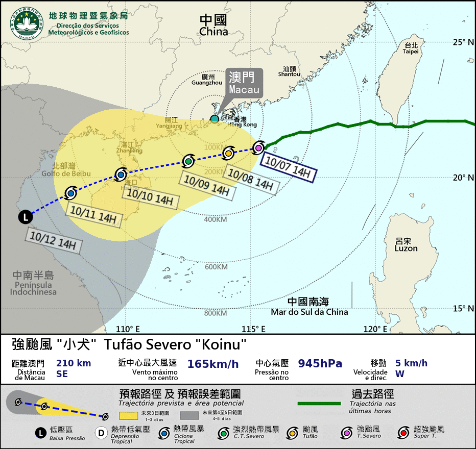
The Meteorological and Geophysical Bureau (SMG) said in a statement this afternoon that there was a "relatively low to medium possibility" that it will hoist the Gale and Storm Warning Signal No.8 tomorrow afternoon or evening.
The observatory hoisted the Strong Wind Signal No.3 at 2 a.m. today.
No.8 is the third highest of Macau's five-level (1, 3, 8, 9, 10) tropical cyclone warning system. The hoisting of the Storm Warning Signal No.8 means that public bus transport and ferry services would be suspended. Depending on the severity of the situation, some or all casinos and other entertainment venues would be closed as well.
At 7 p.m. today, Severe Typhoon Koinu was located about 200 km southeast of Macau, according to an SMG statement, which noted that Koinu "is moving slowly westward, approaching the coastal area of Guangdong" province. The observatory forecast that Koinu will "approach the Pearl River Delta in the next two days." It predicted occasionally heavy rainfall for tomorrow and on Monday.
The weather bureau also said that Koinu's "circulation is small, and its intensity and track remain uncertain," adding that Koinu may come closest to Macau within a distance of 150 km tomorrow, possibly resulting in gale-force winds affecting Macau.
"Therefore, the possibility of issuing higher tropical cyclone signals [higher than the Strong Wind Signal No.3] cannot be ruled out," the bureau said.


