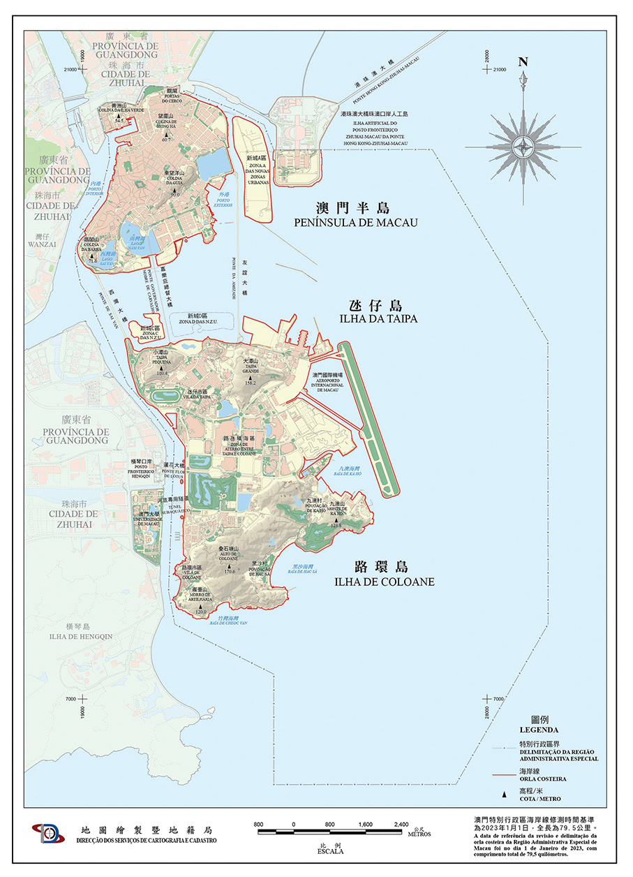
The length of Macau’s coastline has increased to 79.5 kilometres, an increase of 2.8 kilometres from the 76.7 kilometres in 2018, the Mapping and Land Registry Bureau (DSCC) has announced.
A DSCC statement on Monday noted that the increase in coastal length over the period is primarily due to the completion of the Zone C land reclamation project in late 2022.
The Zone C land reclamation project off the sprawling Ocean Gardens residential estate on the north-western Taipa waterfront got off the ground in late 2018 and was completed in November 2022.
According to the statement, Macau’s 79.5-kilometre coastline now comprises the peninsula’s 18.5 kilometres, 49.5 kilometres of the Islands consisting of Taipa, Cotai and Coloane, the Zone A land reclamation area’s 5.7 kilometres, 2.7 kilometres of the Macau checkpoint zone of the Hong Kong-Zhuhai-Macau Bridge (HZMB), and Zone C’s 3.1 kilometres.
According to the DSCC website, the coastline of the peninsula has increased by 0.1 kilometres to 18.5 kilometres from the 18.4 kilometres in 2018.
However, according to the website, the coastline length of the Islands (Taipa, Cotai and Coloane) has dropped by 0.4 kilometres to 49.5 kilometres from 49.9 kilometres in 2018.
Consequently, despite the completion of the 3.1-kilometre-coastline Zone C and the increase of 0.1 kilometre in the peninsula’s coastline length, Macau coastline has increased by 2.8 kilometres from 2018.
According to the DSCC website, Macau’s coastline length stood at just 41 kilometres in 2000, the first year after the establishment of the Macau Special Administrative Region (MSAR) on December 20, 1999.
Macau’s land area amounts to 33.3 square kilometres, a 39.9 percent increase from the 23.8 square kilometres at the end of 1999, according to DSCC figures.

This map released by the Mapping and Land Registry Bureau (DSCC) on Monday shows Macau’s new coastline indicated by the red line.


