During the Christmas holiday, I once again walked all the way to the top of the 158.2-metre Big Taipa Hill (Taipa Grande) before walking to the top of Macau’s highest hill for the first time, the 170.6-metre Coloane Hill (Coloane Alto). This hobby, called hiking or hillwalking, does not simply mean walking up stairs and slopes to me, but a chance to view Macau’s urban landscape and, perhaps more importantly, appreciate its largely conserved countryside.
How it became a hobby
A few years ago, I came up with the idea of walking from the bottom to the top of Macau’s different hills, with the purpose of indicating the extraordinary ease with which fairly healthy people can walk from the foot to the top of Macau’s highest hills, especially when compared to Hong Kong where many of its mountains are over 400 or even 500 metres high, with the highest one, Tai Mo Shan (“Big Cap Hill”), reaching an elevation of 957 metres.
Photos taken by Tony Wong during the Christmas holiday
Time tests
With my goals in mind, I went on to see how long it would take me to walk from the bottom to the top of Macau’s highest hills. The 90-metre Guia Hill was my first test a few years ago. It is the peninsula’s highest. Walking from Vasco da Gama Garden to Guia Lighthouse took me just 10 minutes.
Afterwards, I hiked the even smaller Penha Hill, the top of which is just 62.7 metres high, because it is also where one of Macau’s tourist attractions, the Chapel of Our Lady of Penha, stands. The length of time needed to reach the top depends on which route one chooses. For my test, I walked from the Obra das Mães (“Mothers’ Work”) charity on the Sai Van (“West Bay”) Lake waterfront, which took me seven minutes and 30 seconds, while it took an even shorter six-minute walk when I chose to start at the uphill street next to the Sai Van On Kei “cha chaan teng” (a traditional Hong Kong and Macau-style café).
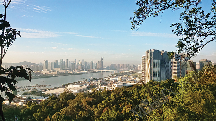
Then, it was time for Taipa Grande, the highest one in Taipa. I walked from the uphill road opposite the Lago (“Lake”) public housing estate, which can be considered as the foot of the hill, to its viewing platform. This is where one can take great photos of the integrated resorts in Cotai. This section’s uphill walk took me five minutes.
Near the viewing platform, one can see a staircase leading uphill, where one can walk up to the hilltop, and the “steep” climb up the steps took me 13 minutes to reach the 158.2-metre hilltop. Altogether, the walk to the top took just 18 minutes.
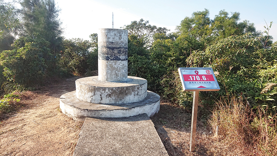
Tackling the highest one: the hike up Coloane Hill
By the end of the Christmas holiday, my plan to test how long it would take me to walk from the foot of Coloane Hill to its peak came to fruition. My previous visits to this hill were just about going to the A-Ma Cultural Village and its nearby 19.99-metre A-Ma Statue by car.
Initially, I mistakenly thought that the location where the statue stands was Coloane Hill’s highest point, before discovering during the holiday that that the 170.6-metre hill is actually located nearby. After identifying the highest point with the help of the Municipal Affairs Bureau’s (IAM) hiking map and YouTube clips made by local hiking enthusiasts, I got my test off the ground.
I walked from the traditional Chinese style archway (“paifang”), which marks the entrance to the A-Ma Cultural Village near the hilltop, on Estrada de Seac Pai Van. After walking along Estrada do Alto de Coloane for a while, one will go past the government’s Public Health Clinical Centre.
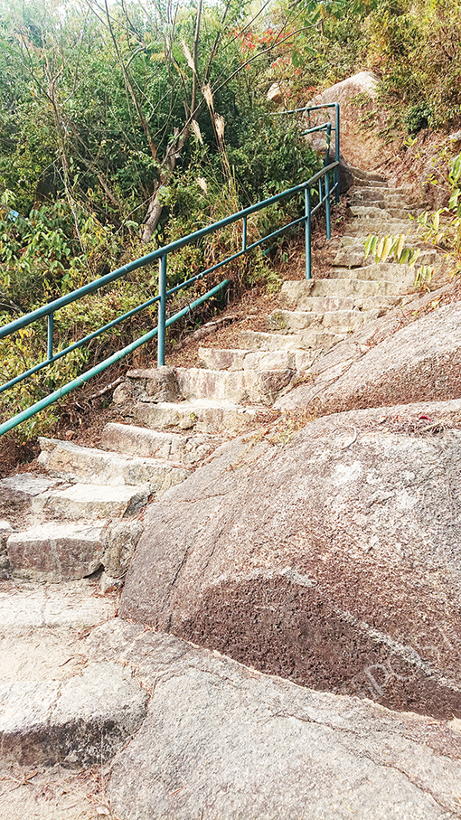
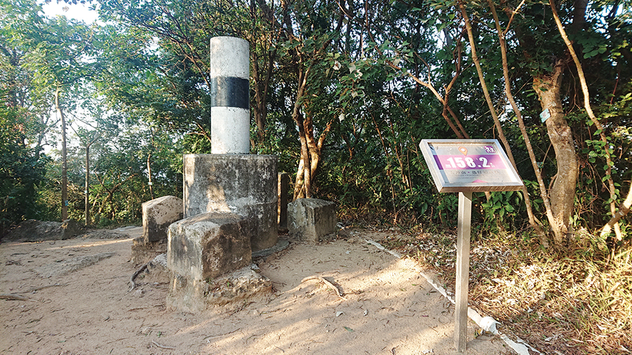
Near the final destination, one will see a small open-air carpark, which is not the biggest one outside the village. From here, if one continues to walk on the left, one will arrive at the village, while taking a U-turn on the right will lead to a narrower road, leading up to the hilltop, which is where one can also see one of the government’s several GPS Reference Stations. Reaching this point, I realised I had finally done it, with the walk only lasting 25 minutes.
From tests to regular walks
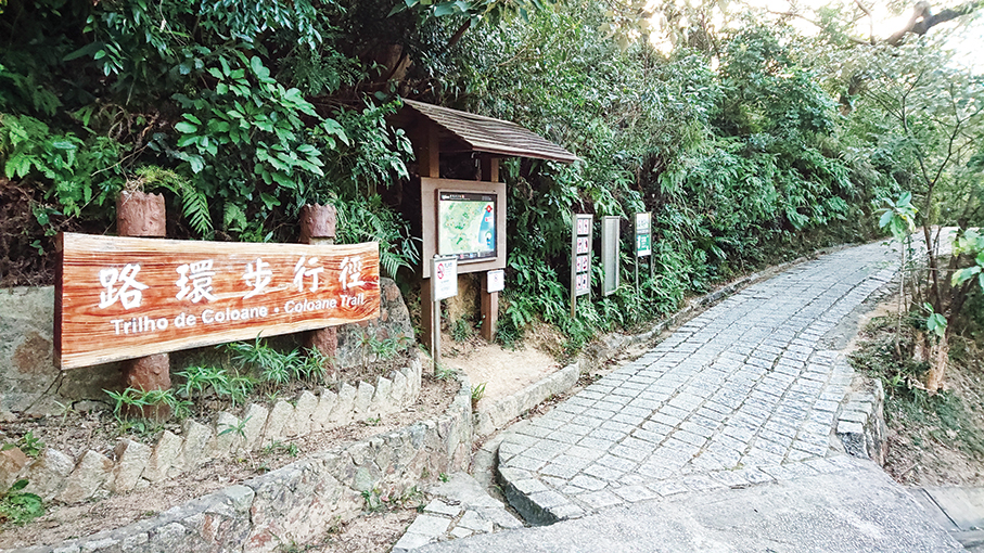
That hike up the Coloane Alto’s hill has resulted in regular walks through its main walking trail, the Coloane Trail, during weekends nearly every week. But I admit that I will certainly suspend hillwalking in the summer. ‘Alto” means “top” in Portuguese.
Coloane Trail is Macau’s longest hillwalking trail, measuring 8,100 metres in length.
Now my regular walks on Coloane Trail are not only good exercise for me but also an occasion that enables me to appreciate the fact that while Macau has its integrated mega-resorts allowing residents and tourists alike to spend their day, there is also very easy access for them to admire the beauty of nature by visiting Macau’s peaks.
Should you intend to embark on hillwalking in Macau, just visit this page of the IAM Nature Web (https://nature.iam.gov.mo/e/trails/list) for information.