The government started to collect opinions and suggestions from the public yesterday on the report of the ongoing environmental assessment of an undersea tunnel project between the land reclamation areas known as Zone A and Zone B, the Lands, Public Works and Transport Bureau (DSSOPT) said in a statement yesterday.
According to the statement, the local government has commissioned the South China Sea Institute of Oceanology of the Chinese Academy of Science to carry out the environmental assessment of the project. The Guangzhou-based institute has completed drafting the environmental assessment report.
Residents can submit their opinions and suggestions until July 3 by letter, phone, fax and email to the bureau or the entity tasked with carrying out the environmental assessment, the statement said. Residents can go to https://www.dssopt.gov.mo/zh_HANT/home/information/id/205 to check details on the project and the environmental assessment work, in both Chinese and Portuguese languages. The environmental assessment drafted by the South China Sea Institute of Oceanology that can be downloaded from the website is available in Chinese only.
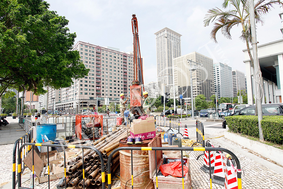
This undated handout photo provided by the bureau yesterday shows the entity tasked with the environmental assessment of the planned tunnel project surveying the waterfront Avenida Dr. Sun Yat-Sen in Nape.
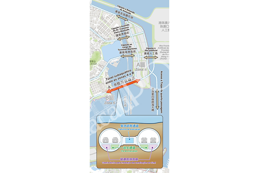
This picture provided by the Lands, Public Works and Transport Bureau (DSSOPT) yesterday shows the planned tunnel project (indicated by the red arrow) between Zone A and Zone B. The first arrow from the top indicates the existing link – the only one currently – between the peninsula and Zone A (at the peninsula’s Oriental Pearl roundabout). The second arrow from the top indicates the planned link from Zone A to Avenida do Dr. Francisco Vieira Machado and Rua dos Pescadores. The third arrow from the top on the left hand side indicates the planned link from Zone A to near the Outer Harbour Ferry Terminal. The horizontal arrow on the right-hand side indicates the existing link between Zone A and the man-made island for the Macau checkpoint of the Hong Kong-Zhuhai-Macau Bridge (HZMB). The vertical arrow indicates the planned Macau-Taipa fourth link.
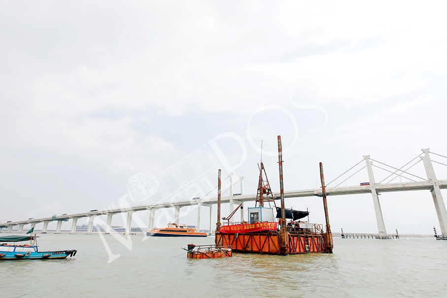
This undated handout photo released by the bureau yesterday shows the entity tasked with the environmental assessment of the planned undersea tunnel project carrying out a technical survey in the Outer Habour.
PLEASE READ THE FULL ARTICLE IN OUR PRINT EDITION.


