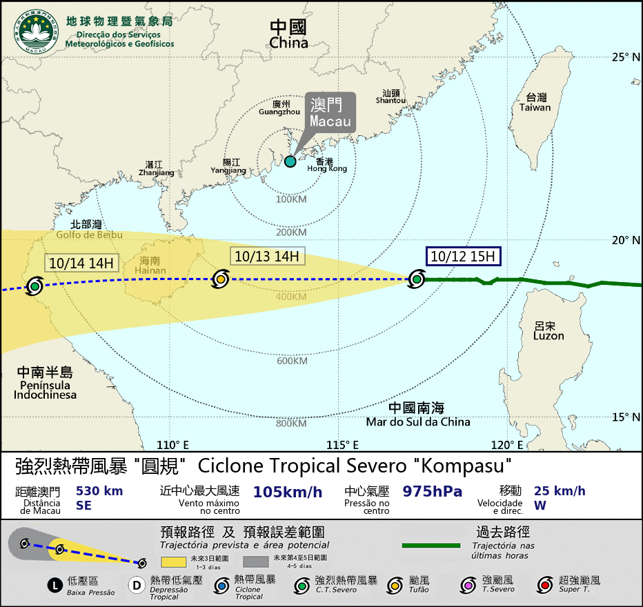
Macau's observatory hoisted the Strong Storm Signal No. 3 at 6 a.m. today as Severe Tropical Cyclone "Kompasu" was lurking in the South China Sea en route to Hainan island, the nation's southernmost province.
According to a statement by the Meteorological and Geophysical Bureau (SMG), at 2 p.m. "Kompasu" was located about 550 km southeast of Macau. The cyclone was "intensifying gradually", the bureau said.
Signal No. 3 means that under the influence of a tropical cyclone, winds with a sustained speed of 41 to 62 km/h are expected or blowing, and gusts may exceed 110 km/h in the city.
Macau has a five-signal typhoon warning system: 1 (standby), 3, 8, 9, and 10.
The bureau issued the Blue Storm Surge warning at 11 a.m. today. It forecast flooding in the low-lying areas of the peninsula's Inner Harbour area between 9 p.m. tonight and 3 a.m. tomorrow, with floods below 0.50 metre.
The Blue Storm Surge warning means that the flood level is expected to remain below 0.50 metre above road level. It is the lowest of a five-level storm surge warning system (Blue, Yellow, Orange, Red, Black).
The weather station said this afternoon that Typhoon Signal No. 8 may be hoisted between 8 p.m. and 11 p.m. today.
Signal No. 8 means that a tropical cyclone continues to approach Macau. Winds with a sustained speed of 63 to 117 km/h are expected or blowing and the gusts may exceed 180 km/h in the city.
It is the second typhoon in four days to affect Macau. Signal No. 8 was hoisted on Saturday when "Lionrock" passed by the city en route to Hainan. The storm caused only minor damage and a few injuries in Macau.
HK observatory expects to hoist Signal No. 8 at 5:20 p.m.
Meanwhile, the Hong Kong Observatory said this afternoon it expects to issue Signal No. 8 at or before 5:20 p.m. as "Kompasu" nears the city.
At 3 p.m., "Kompasu" was about 500 km southeast of Hong Kong, and was forecast to move west at about 25 km an hour across the northern part of the South China Sea towards the vicinity of Hainan.


