According to a statement from the Mapping and Land Registry Bureau (DSCC) yesterday, an updated version of its “Walking Routes Map” and thematic website was launched following the enhancement of Macau’s various walking systems and facilities, and the opening of a pedestrian walkway along Avenida de Guimarães in Taipa.
The updated platforms were launched in conjunction with the Transport Bureau (DSAT), the Lands, Public Works and Transport Bureau (DSSOPT), the Municipal Affairs Bureau (IAM) and the Cultural Affairs Bureau (IC), the statement noted.
The statement pointed out that the updated thematic website incorporates walking route information from various departments, with a total of 37 walking routes across various districts in the city. These consist of 10 routes from the “Walking Routes Map”, 19 routes from IAM’s “Taking a Walk through the Streets of Macao-Knowing about Macao”, and eight routes from the Cultural Affairs Bureau’s “Macao Cultural and Creative Map”.
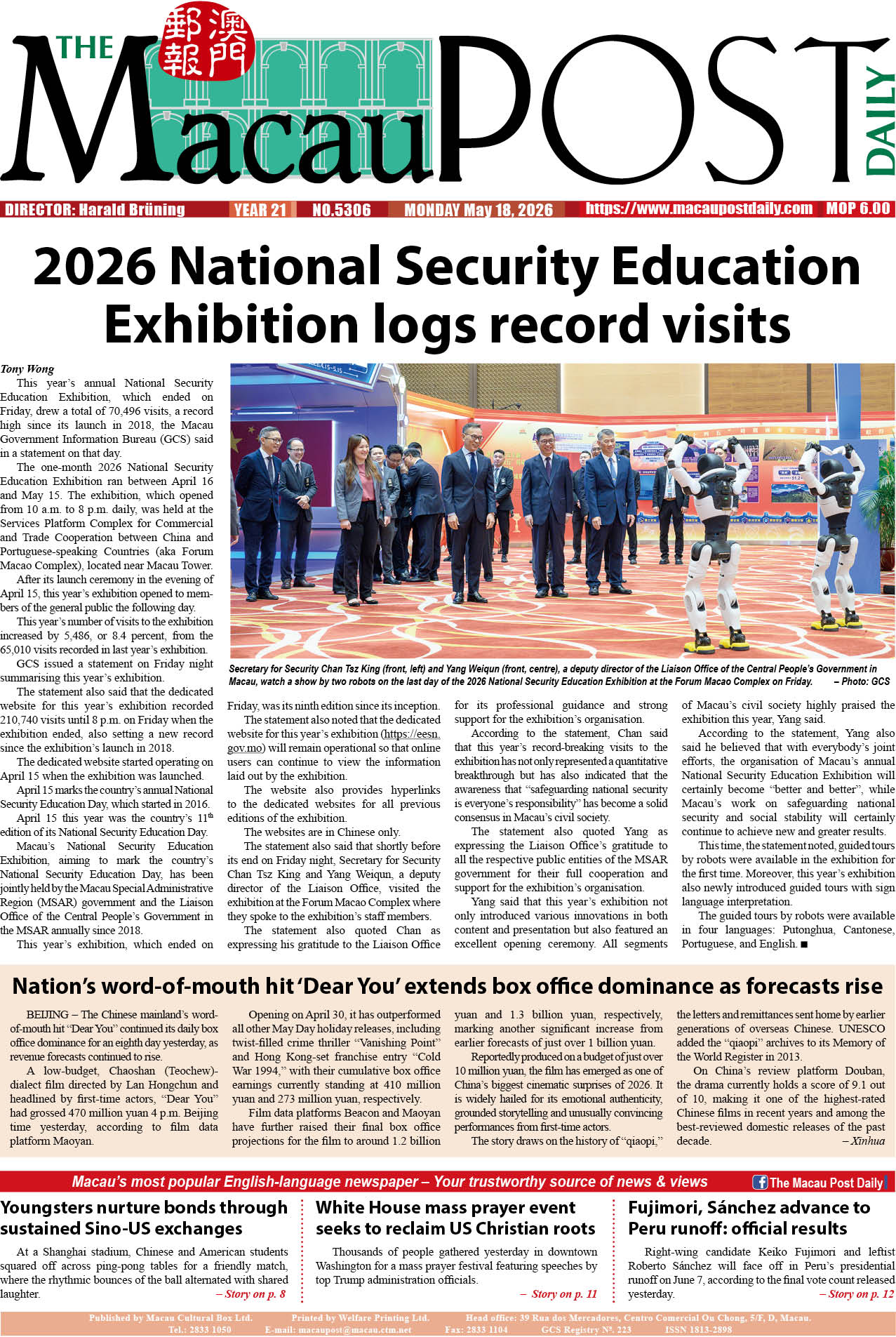
The statement added that the updated website also added a walking route on the pedestrian walkway along Avenida de Guimarães, introducing the walking route and the required walking time between the LRT Stadium Station, Olympic Sports Centre, Taipa Central Park, and Taipa Village.
Also updated are the Cheok Kun Pavilion Escalator and Walkway System’s route maps, as well as the walking route between Lakeside Garden and Taipa Houses and the Escalator and Walkway System at Baía de Nossa Senhora da Esperança. The statement underlined that this offers location information of “various cross-district walking systems, pedestrian crossing facilities, car parks, bus stops, taxi stops and light rail stations”.
The website can be accessed using computers or mobile devices to learn about the routes, as well as view “scenic spots” through the 360 panoramic photos. The statement said that public can visit the website https://routemap.dscc.gov.mo/en/ or scan the provided QR code.
Using a mobile device to browse the map also allows for real-time location information, which the statement said encourages the public to “take ecological tours through geographic information technology”.
This image shows the walking route of the pedestrian walkway along the Avenida de Guimarães in Taipa.

This image shows a QR code for the walking routes’ thematic website.