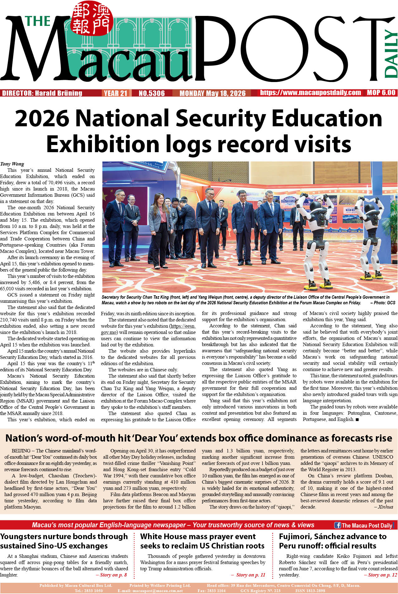
Macau’s Mapping and Land Registry (DSCC) said in a statement yesterday that the launch of an updated version of the “GeoGuide for emergency” app enables the public to obtain the latest geographic information of any emergency situation from relevant government entities.
The app – version 3.3 – provides geographic information such as areas expected to be affected during any storm surge levels and zones that may experience power suspensions, “Emergency Shelter” and “Meeting Place / Place to Stay for Emergency Evacuation”, according to the statement.
Also provided, the statement underlined, are walking routes to the nearest emergency shelters for planning purposes, the Meteorological and Geophysical Bureau’s (SMG) real-time severe weather warning information and water level monitoring information, as well as real-time maritime information from the Marine and Water Bureau (DSAMA) when connected to the internet.
Moreover, the statement noted that the updated app provides various kinds of emergency information and risk or disaster prevention guidelines such as the “Emergency Shelter” provided by the Social Welfare Bureau (IAS) and the Education and Youth Development Bureau’s (DSEDJ) “Class suspension arrangements when rainstorm signals or tropical cyclone signals are hoisted, or in case of special weather conditions”. Maps for emergencies are also available in the app online or offline.
The app is available in traditional and simplified Chinese, English and Portuguese.
The statement said that the free app can be downloaded both through the App store or Google Play, while further details can be found at https://www.dscc.gov.mo.