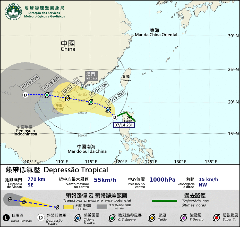
Macau's observatory has hoisted the Tropical Cyclone Warning Signal No.1 tonight.
According to a statement by the Macau Meterological and Geophysical Bureau (SMG), the standby signal was issued at 10:30 p.m. today. At 10 p.m., the tropical cyclone was located 770 km southeast of Macau.
Signal No.1 is the lowest of Macau's tropical cyclone warning signals. It is hoisted when a typhoon comes within 800 kilometres from Macau. Its higher warning typhoon signals are No. 3, No. 8, No.9 and No.10.
According to the statement, the tropical cyclone is expected to move northwest, generally towards the area between the west coast of Guangdong province and Hainan province.
"It is expected that the tropical cyclone will strengthen gradually in the coming few days," the statement said, adding that the observatory "will consider the possibility of issuing higher tropical cyclone signals owning to its development. Under the influence of its associated outer subsidence airflow, the weather in Macau will be extremely hot this weekend, and the high temperature may trigger thunderstorms with strong gusts in the afternoon."
The observatory also said that under the joint effect of storm surge and astronomical tide, flooding might occur in the Inner Harbour area with flooding levels between 0.3 to 0.7 metre next Monday and Tuesday.
The bureau also said that there was a "medium to relatively high chance" that it will hoist the Tropical Cyclone Warning Signal No.3 on Sunday afternoon or evening.
According to the bureau, "it is expected to be extremely hot in Macau tomorrow. The maximum temperature will be 36°C or above in some areas. The public should beware of heatstroke, avoid outdoor activities under the hot sun, and drink more water."


