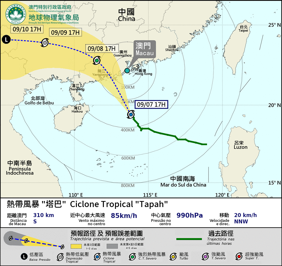
The Macau Meteorological and Geophysical Bureau (SMG) announced this afternoon that Tropical Storm "Tapah", located in the northern part of the South China Sea, is forecast to move north to north-westward and gradually intensify, heading generally towards the western coast of Guangdong Province.
According to the current forecast track, Tapah will pass within 150 km to the south-west of Macau early tomorrow and strengthen further. As the storm's circulation area is relatively small, winds in Macau are expected to increase significantly tonight. The observatory also said that winds were predicted to reach force 8 to 9 early tomorrow. Therefore, the Tropical Cyclone Signal No. 8 will be issued at 9:00 p.m. today, it said.
The bureau also said that under the influence of Tapah's outer circulation, there will be frequent heavy showers and thunderstorms from tonight into tomorrow.
Meanwhile, the statement advised that a combination of an astronomical high tide and a storm surge in the coming days may cause flooding in the Macau Peninsula’s Inner Harbour area. Floodwaters between 0.5 metres and one metre are expected during daylight hours tomorrow.
The Yellow Storm Surge Warning is currently in effect. The bureau added that if Tapah shifts onto a path closer to the Pearl River Delta and intensifies more than expected, the impact of the storm surge would be more severe. Consequently, the possibility of issuing an Orange Storm Surge Warning could not be ruled out. The Orange warning is the third highest level in Macau's five-level storm surge warning system (Blue, Yellow, Orange, Red, Black).