The Meteorological and Geophysical Bureau (SMG) said in a statement yesterday there’s a “relatively high” probability of hoisting Tropical Cyclone Signal No. 3 early today.
The observatory issued Standby Signal No.1 at 9 a.m. yesterday, which will remain in effect for the time being, according to the statement.
The weather station also issued a Blue Storm Surge warning yesterday, and expected that flooding will occur in low-lying areas. The statement said that there was a “low” probability of hoisting a Yellow Storm Surge warning today.
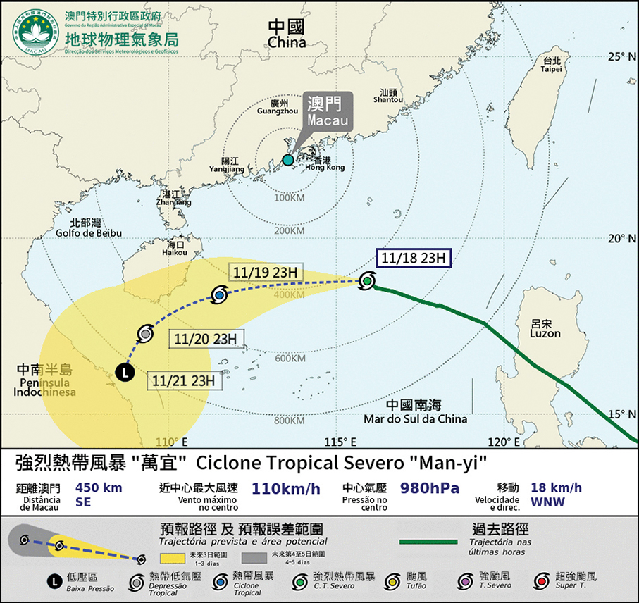
According to the bureau, at 5 p.m. yesterday Tropical Cyclone Man-yi was located about 520 kilometres east-southeast of Macau, moving west-north-west at about 18 kilometres per hour, and was expected to pass the northern part of the South China Sea in the next two days, before turning south-west, weakening gradually.
The observatory forecast that Man-yi will come closest to Macau today, passing about 350 kilometres south of Macau.
Under the influence of Man-yi and the current astronomical tides, the statement said, the low-lying areas in the Inner Harbour area will remain flooded by 0.5 metre or less today.
The flooding in the vicinity of Praça de Ponte e Horta intensified last night, rendering some roads impassable, according to social media reports late last night.
Under the combined influence of Man-yi and the northeast monsoon, gusty winds are expected in Macau today, and the temperature will drop slightly with a few showers, while the rain will gradually become more frequent, said the observatory, which urged the public to pay close attention to the latest weather information and to take precautionary measures in a timely manner.

This infographic provided by the Meteorological and Geophysical Bureau (SMG) yesterday shows the expected track of Tropical Cyclone Man-yi which could affect Macau.


