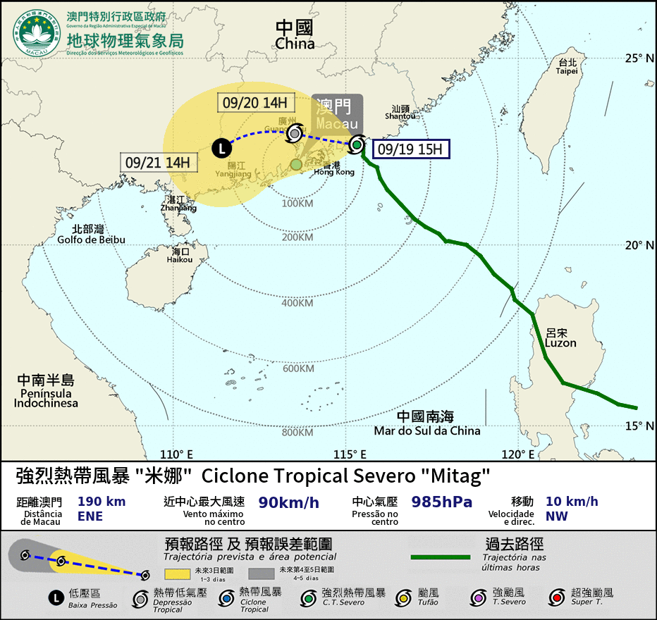
Macau’s Meteorological and Geophysical Bureau (SMG) hoisted the Strong Wind Signal No. 3 this morning. The signal indicates that winds with sustained speeds of 41 to 62 km/h are expected or are already blowing, with gusts that may exceed 110 km/h.
The T3 signal was issued at 7 a.m. In a statement issued at 3:21 p.m., the observatory said Tropical Cyclone ‘Mitag’ is "expected to gradually turn westward between this afternoon and evening, making its closest approach to Macau tomorrow morning.
"Given its relatively small circulation and the ongoing uncertainties regarding its intensity and track, it may pass within about 100 kilometres of Macau.
"Therefore, the possibility of issuing a higher Tropical Cyclone Signal cannot be ruled out.”
The weather station also stated that, "affected by the outer circulation of ‘Mitag’, Macau is expected to experience more thundery showers with strengthening winds from later today." It added that tomorrow and on Sunday, "there will be frequent heavy showers and thunderstorms, accompanied by gusts. Flooding may occur due to short-term heavy rainfall."
The bureau noted that the probability of hoisting Tropical Cyclone Signal No. 8 between tonight and tomorrow morning is "relatively low".
Macau maintains a five-level tropical cyclone warning system – 1, 3, 8, 9, and 10.