

The Meteorological and Geophysical Bureau (SMG) said on its website yesterday that the probability of issuing Strong Wind Signal No.3 remains “relatively low”, but also noted that there is still “significant uncertainty” in the track of Tropical Cyclone “Saudel” for later this week.
Standby Signal No. 1 remains hoisted through this morning, the observatory said.
According to the bureau’s website, Tropical Cyclone “Saudel” was yesterday located at the north-eastern part of the South China Sea and was “moving slowly”, and is expected to linger in that area today.
“The chances of Macau being directly affected by its circulation is relatively low”, the bureau said.
However, the bureau added that the path of “Saudel” remains uncertain later this week and could shift westwards over eastern Guangdong and head back towards the Pearl River Estuary, which could strengthen winds and increase showers in Macau.
The bureau said that it is closely monitoring the situation.
Meanwhile, the Tropical Cyclone Track on its website noted that as of 11:00 p.m. yesterday, “Tropical Storm Saudel was estimated to be about 450 kilometres east of Macau and was forecast to move northeast at around 10km/h”, edging closer to the eastern coast of Guangdong.
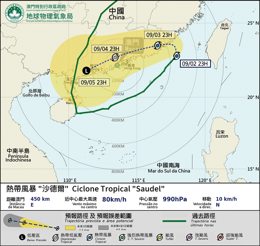
This image downloaded last night from the Macao Meteorological and Geophysical Bureau’s (SMG) shows the actual tropical cyclone track for Tropical Storm “Saudel”.