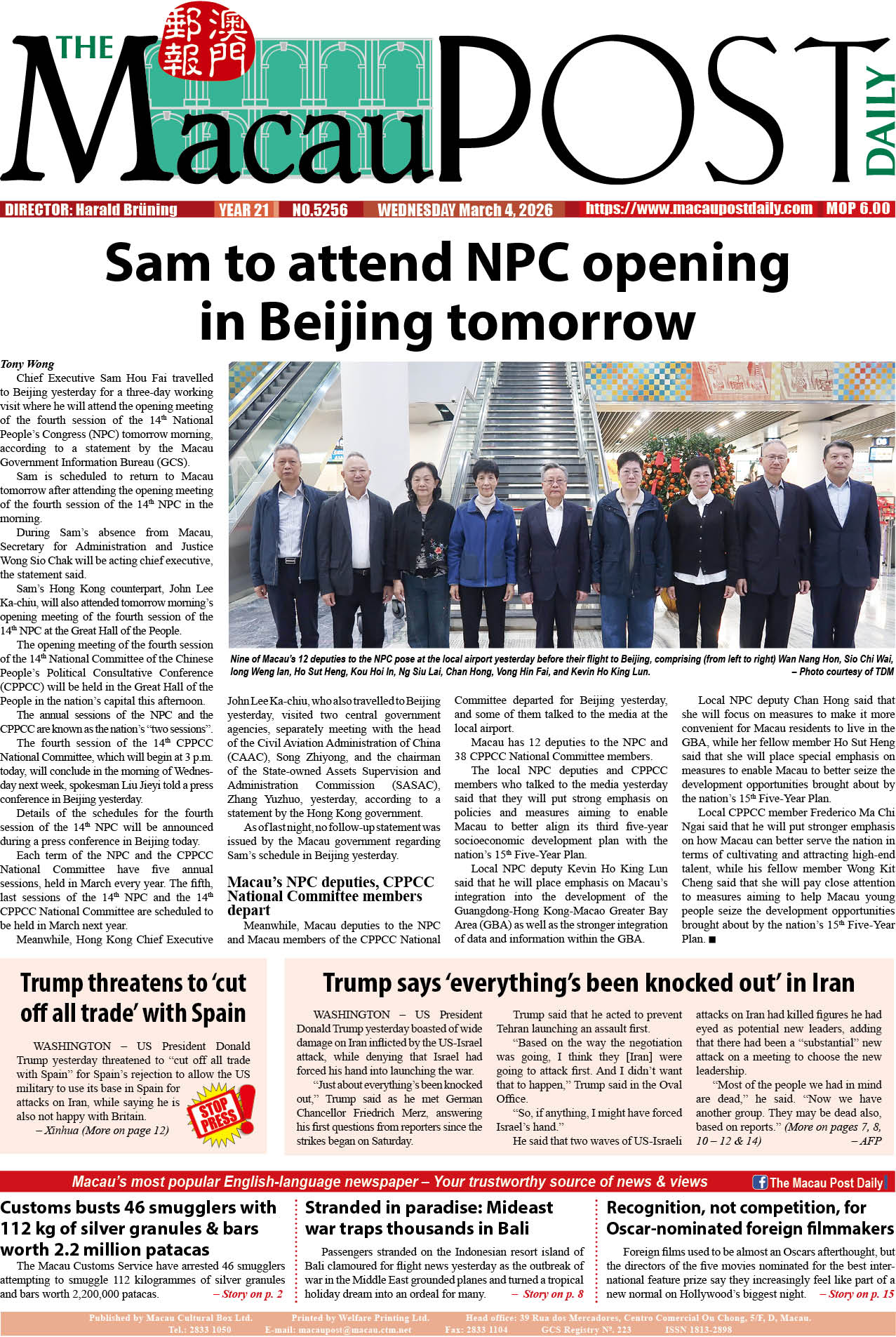
The government promulgated its official plan for the Macau Special Administrative Region’s (MSAR) marine functional zoning in the Official Gazette (BO) yesterday, according to which the city’s 85-square-kilometre coastal waters are divided into 19 zones designated for different uses and functions.
The plan, which takes effect on Monday next week, will be valid until 2040.
According to the plan, the 19 zones comprise the protected natural zone, special protected zone, reserved zone, zone for port operations, zone for navigation channels, anchorage zone, zone for roads, bridges and tunnels, zone for airport construction, safety zone for the ongoing Light Rail Transit (LRT) East Line project, safety zone for navigation channels, zone for urban construction, zone for industrial purposes, zone for submarine cables and pipelines, zone for tourist landscapes, zone for cultural, sporting and leisure purposes, waste disposal zone, zone for the disposal of dredged materials, maritime exclusion zone for the airport, and zone for other special purposes.
The waste disposal zone listed by the plan is where the local government is proposing to build its “ecological island” for the disposal of the city’s growing construction waste.
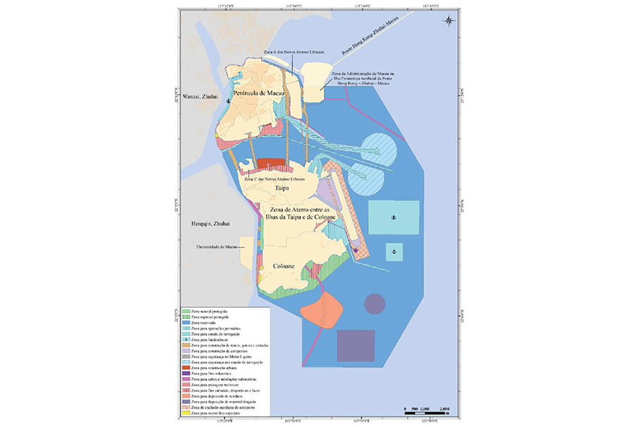
This map published in the Official Gazette (BO) yesterday shows the official plan for Macau’s marine functional zoning, including the government’s proposed ecological island indicated in orange south of Coloane island.